

A mainly dry, windy weather pattern continues this week and into the weekend with warming temperatures late this week as high pressure aloft builds. Except for a stray shower chance Tuesday night into Wednesday morning, it looks dry. The next chance of rain arrives next Monday night as an upper level low moves across the Plains.
Strong onshore winds and long period swells will give us the potential for minor coastal flooding the next few days. There is a Coastal Flood Advisory until 1 PM Wednesday for beach inundation of up to 1 foot. High tide occurs in the morning Wednesday at 8:57 A.M. at Bob Hall Pier and 9:24 A.M. at Port Aransas.
Rough surf at 4-6 feet is expected Wednesday and southeast winds at 20-25 mph with a high rip current risk.
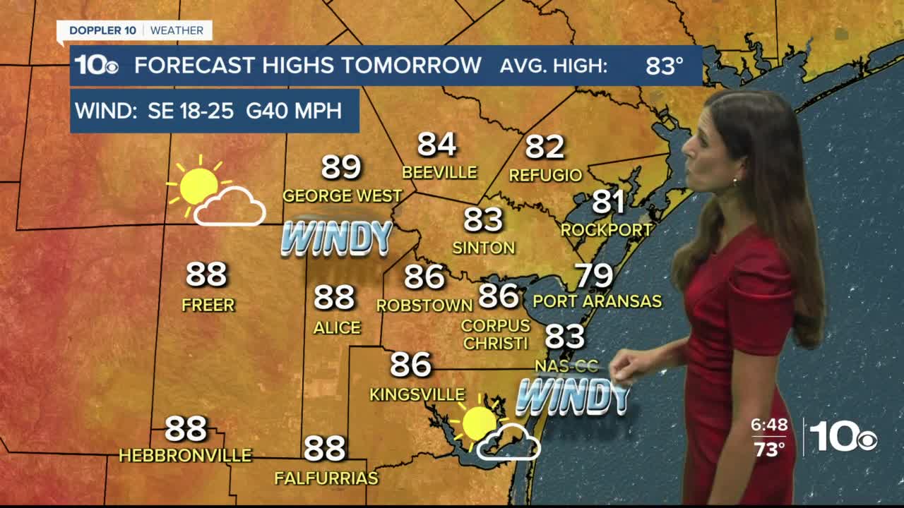
There is a stray shower chance Tuesday night into early Wednesday with cloudy skies through the morning to partly sunny skies in the afternoon and southeast winds at 18-25 mph, gusting up to 40 mph. Highs will reach the upper 70s at the beaches to near 90 inland Wednesday.
Temperatures will warm more Thursday into the weekend. Inland areas will see hot afternoons, reaching into the lower 90s with Corpus Christi reaching the upper 80s and near 80 at the beaches.
It will be windy each day with southeast winds at 18-25 mph, gusting to 40 mph at times through the weekend.