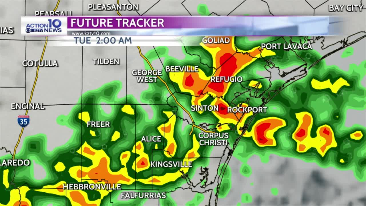


CORPUS CHRISTI, Texas — A cold front will move south and stall out in just north of the Coastal Bend late tonight. Thunderstorms will develop ahead of the front and move south through early Tuesday morning.
The atmosphere is very moist so some of the storms will produce heavy rainfall but not everyone will get in on it due to the scattered nature of the storms. Also, stronger storms could produce strong wind gusts as they move through.
The front will stay just to our north Tuesday then move north as a warm front Wednesday. Isolated t-storms are possible Tuesday afternoon and Wednesday but most areas will stay dry.
It won't be as hot on Tuesday but we'll still have seasonal heat and humidity with highs near 90 and heat indices from 100-105 Tuesday afternoon with easterly winds 8-15 mph.
Winds will shift to the southeast Wednesday and humidity will be higher with highs in the lower 90s and heat indices from 104-109 and southeast winds at 12 to 22 mph.
The remainder of the week will be hot, humid and dry with high temperatures in the low to mid-90s through Friday and heat indices at 105-110.