

CORPUS CHRISTI, Tx — Happy Monday!
WHAT YOU NEED TO KNOW
- Dangerous heat and near-record temps
- Rain chances today and tomorrow
Following record-breaking and near-record heat this past weekend, we can expect more of the same this week, with some opportunities for shower activity today and tomorrow.
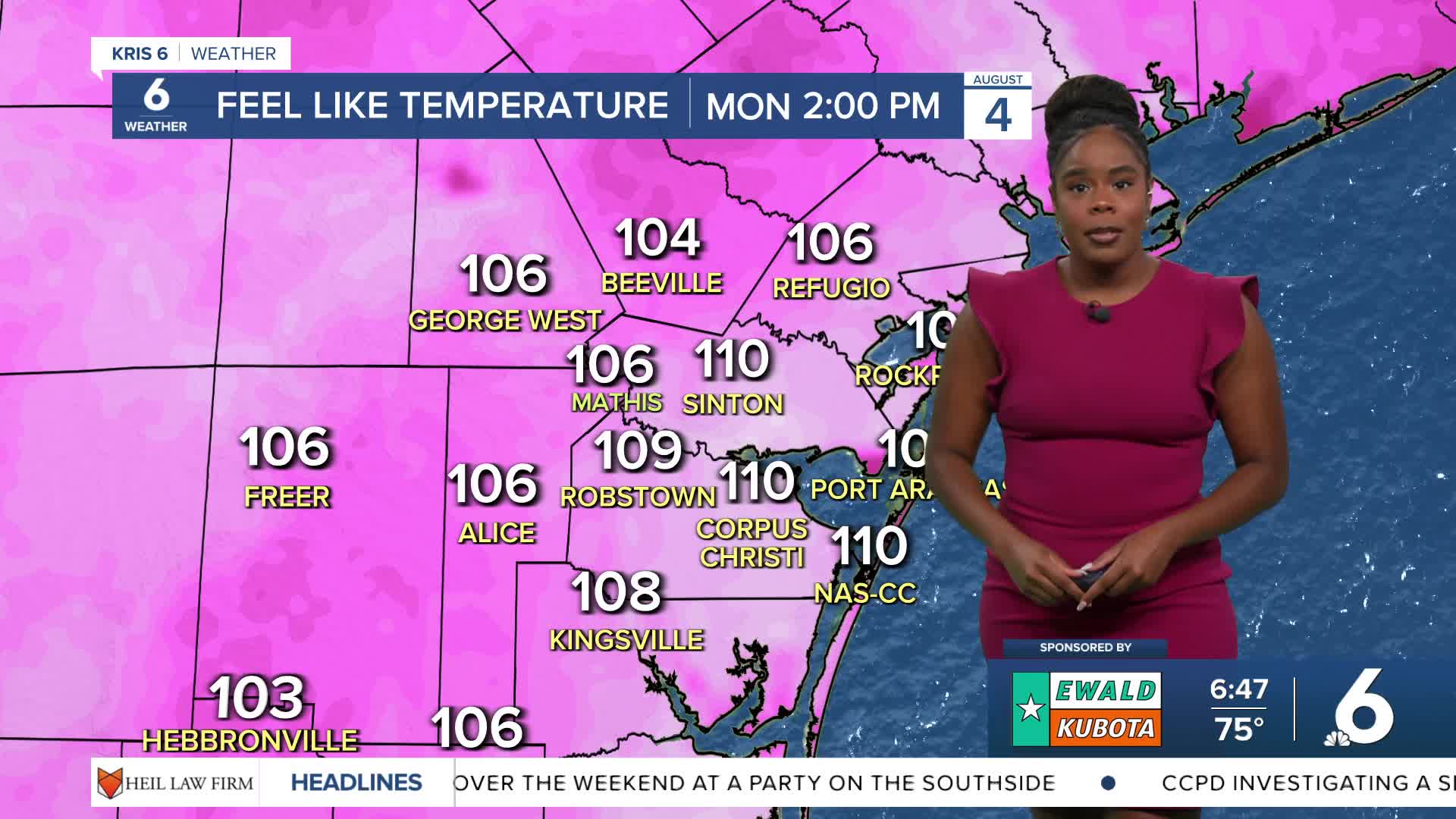
Under mostly sunny skies, temperatures will soar to the upper 90s, and heat indices will reach 110°. Thanks to a wrinkle in the upper levels of the atmosphere, rain chances will enter the forecast late this afternoon into the evening. Northern counties and neighborhoods will have the best chances of seeing these showers and thunderstorms pass through.
More shower activity is expected to extend into Tuesday before conditions dry out.
As for the tropics, Tropical Storm Dexter formed over the weekend and is currently north of Bermuda, forecast to fizzle out in the Atlantic. There are two more areas of interest that the National Hurricane Center is monitoring. First is another area of low pressure off the eastern coast of Florida witha 30% chance of development over the next 7 days. The second is a tropical wave off the west coast of Africa with a 50% chance of development over the next 7 days as it moves northwestward into the Central Atlantic. There are no threats to the Coastal Bend, but we'll keep monitoring these systems.
CORPUS CHRISTI FORECAST
Today: Hot and sunny with afternoon to evening t-showers
Temperature: High 99ºF
Winds: ESE 5-15 mph
Tonight: Partly cloudy & showers wrapping up
Temperature: Low 79ºF
Winds: S 10-15 mph
Tuesday: Mostly sunny & chance for t-showers
Temperature: High 96ºF
Winds: ESE 5-15 mph
Have a great day!