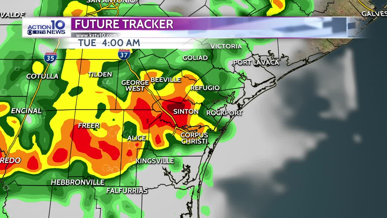


Another round of showers and t-storms is expected late Monday night into Tuesday morning as a weak cold front moves through. Scattered to numerous storms will develop ahead of the front and move in from the west-northwest after 1 AM with rain most likely from 3-7 AM. There is a slight risk of severe storms due to high instability and moderate wind shear in south Texas. Damaging wind of 58 mph or higher is the main threat with a lower threat of large hail of 1 inch or greater. Also heavy rain is expected with stronger storms and could lead to localized flooding. Most areas will get a half inch to an inch of rain, but higher amounts up to 3 inches will be possible. Storms will end Tuesday morning and we'll have a dry afternoon with highs in the low to mid 80s. There is a chance of a few storms late Tuesday night into Wednesday morning. Wednesday and Thursday will be drier and hot with highs reaching the lower 90s inland. Another wave of low pressure will move into south Texas Friday, bringing another chance of storms from Friday through the weekend with seasonal temperatures.
Tonight: Showers and t-storms likely late with lows in the upper 60s to low 70s.
Tuesday: Morning showers and storms ending with highs reaching the low to mid 80s in the afternoon with northeast to east winds at 8-15 mph.
Wednesday: Slight storm chance early then partly sunny, very warm and humid with highs in the low 90s inland to the low 80s beaches.
Thursday: Partly sunny, very warm and humid with highs in the low 90s inland to the low 80s beaches.
Friday: Chance of t-storms with highs in the low 80s to near 90.