CORPUS CHRISTI, Texas — Happy Tuesday!
WHAT YOU NEED TO KNOW
- Moderate heat risk through Wednesday
- Tracking a late-week cold front/rainfall
- Strong storms possible on Wednesday (inland)
HEAT RISK
Even though the heat will be improved on Wednesday, most of the Coastal Bend will still be under a moderate heat risk (2 out of 4). Temps remain warm overnight; Wednesday will begin in the upper 70s, with highs in the upper 80s and lower 90s. Please be sure to stay hydrated! Hazy skies return and reduced air quality will be a concern for some sensitive groups.
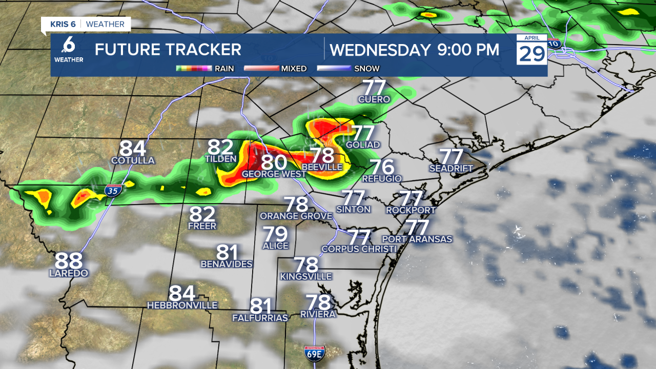
OUR NEXT COLD FRONT
A cold front will be making its way to the Coastal Bend over the next 24 to 48 hours. As the front approaches on Wednesday night, strong storms could impact our inland neighborhoods. Most neighborhood won't see any rain until Thursday, when the front arrives and stalls over the region. This will give us a brief window of rainfall on Thursday and Friday. Some showers will still be possible on Saturday morning when the front 'picks up steam' again and moves south. The timing of this cold front will be a bit tricky, so please continue to check back on the forecast as details become clearer.