
CORPUS CHRISTI, Tx — Good morning and Happy Wednesday Coastal Bend!
WHAT YOU NEED TO KNOW
- Mild start to the day in the 60s
- Wind Advisory for Coastal Areas and Red Flag Warning to the South (Brooks and Inland Kenedy counties)
- Highs in the 80s (90s inland) with breezy conditions this afternoon
- Pushing into the 90s tomorrow for highs more abundantly
- Elevated fire danger through the next few days
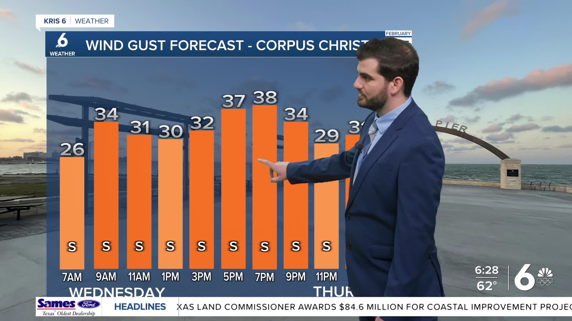
As we start off our last Wednesday of February we're seeing mild temperatures in the 60s for most of our overnight lows. Plenty of sunshine takes us into the 80s and 90s this afternoon. However it will be a windy one again with gusts in the 30-35mph range from the south and southeast.
By tomorrow we'll see the winds calm down, but out temperatures will rise even more into the 90s more commonly across the area. Right now we're forecasting ~93F here in Corpus Christi which would break our previous record of 89F from 2024.
Luckily by tomorrow night we'll see our next cold front work into the area dropping daytime highs back into the lower 80s as we close out February and welcome in March this weekend. Overnight lows don't take too much of a dip settling out in the lower 60s. Unfortunately for now the seven-day forecast looks dry across the area with only ~20% or less rain chances on the board.
CORPUS CHRISTI FORECAST
Today: Mostly Sunny and Windy
Temperature: 88F
Winds: SE 20-30 mph, G 30-40 mph
Tonight: Mostly Clear and Breezy
Temperature: 63F
Winds: SE 10-20 mph, G 20-25 mph
Thursday: Mostly Sunny
Temperature: 93F
Winds: SE 10-20 mph

I hope you have a great Wednesday Coastal Bend!