
CORPUS CHRISTI, Tx — Good morning and Happy Thursday!
WHAT YOU NEED TO KNOW
- Spotty Drizzle possible this morning with more cloud cover
- Partly Cloudy and Breezy into Thursday afternoon
- Warming trend into the weekend pushes high to around ~90F
- Winds from the southeast keep humidity high in the forecast
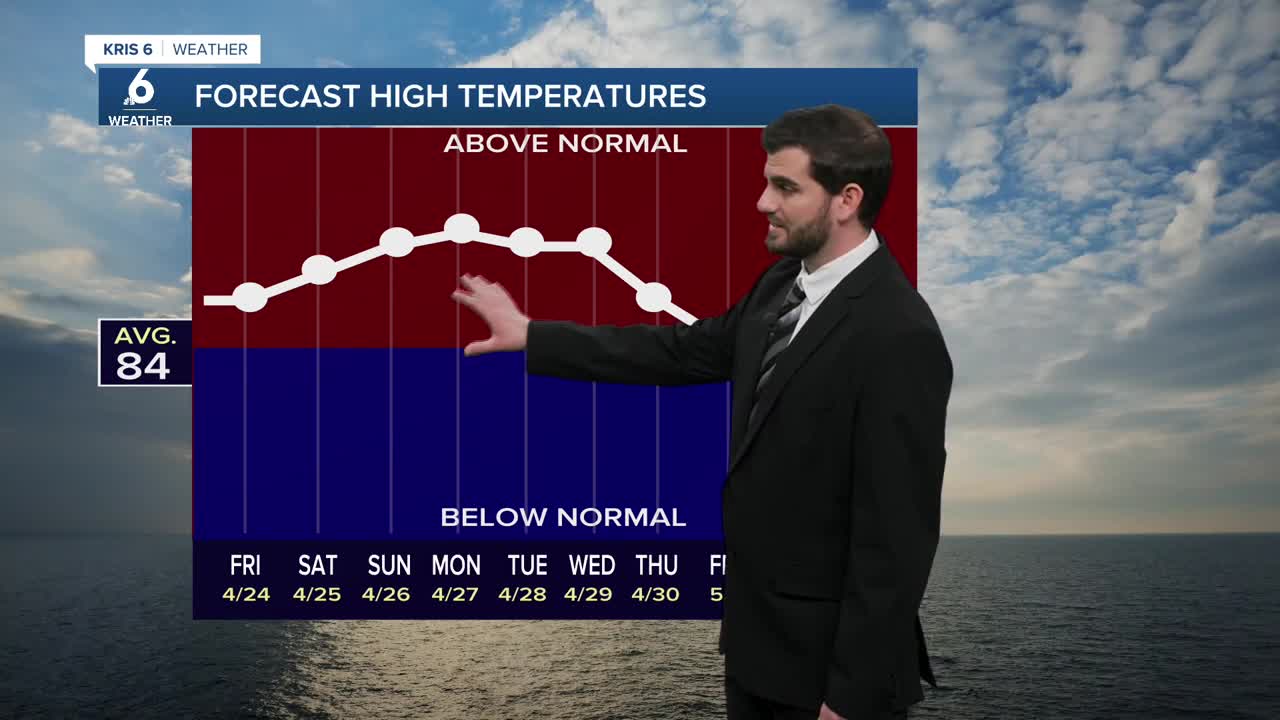
Warming Temperatures
The main focus of the current forecast is going to be the temperatures, for Thursday we'll be pushing the mid to upper 80s for daytime highs. By Saturday we look to be closer to 89F and likely pushing into the lower 90s for inland neighborhoods towards Duval and Jim Wells counties. I do have Corpus Christi also pushing into the lower 90s for Sunday for my latest forecast this morning. Either way it's going to be above average, and when you combine that with our dew points in the low 70s we're all going to be feeling the heat this weekend!
Cloud Coverage
We'll start Thursday morning with increased cloud cover, but as we head into the afternoon more sunshine will show up as we warm up. Friday brings an increase in cloud cover throughout the day, but heading into the official weekend we'll be back on to partly cloudy skies around the Coastal Bend.
Winds
Today is looking breezy in the afternoon with winds around ~20mph but gusting upwards of ~25mph at times from the southeast. Going into the next few days we're anticipating a similar set of winds daily with the afternoon breeze picking up for us, but not being overly windy like we had around the area last week where we were at the 30-40mph range.

I hope you have a great Thursday Coastal Bend!