CORPUS CHRISTI, Texas — Happy Monday!
WHAT YOU NEED TO KNOW
- Oppressively humid and windy
- Heat risk improving by midweek
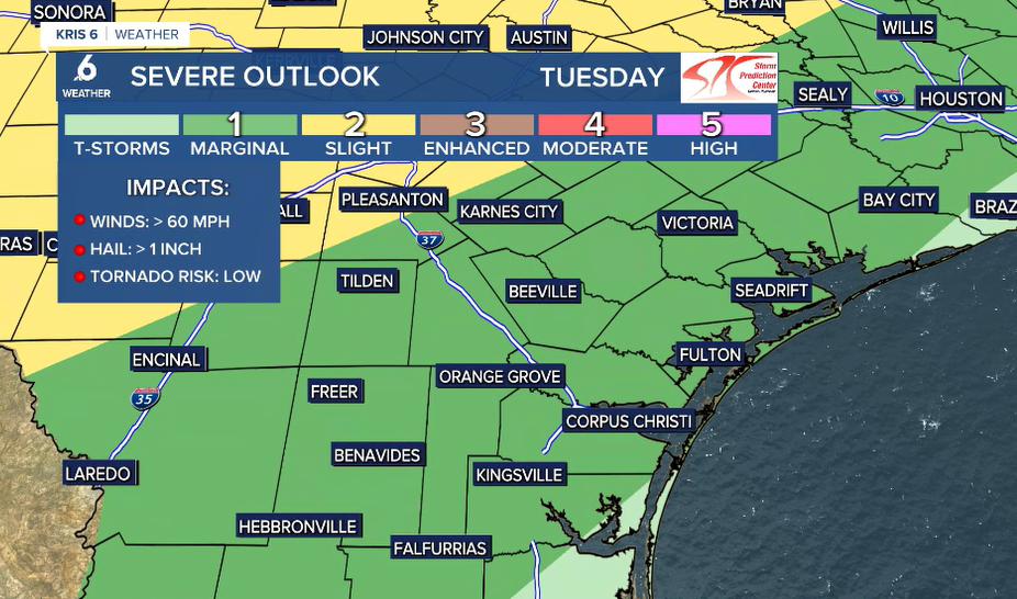
- Chance of severe storms early Wednesday morning
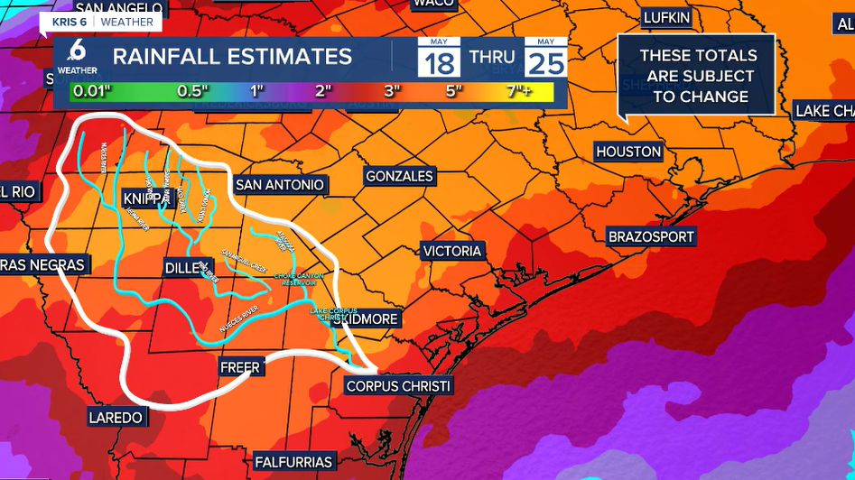
- Heavy rainfall expected Wednesday through Saturday
"AIR YOU CAN WEAR"
The week begins with hot, windy, and humid conditions across the Coastal Bend. While there were a few showers overnight, we haven't seen much relief in our temperatures. The lack of an overnight cool-down is why heat risk remains a concern into Tuesday. Expect morning low temps to remain in the upper 70s while afternoon highs rise to the upper 80s and lower 90s on Tuesday. Strong southeast winds will keep plentiful humidity in our forecast. Please be sure to stay hydrated!
NEXT CHANCE OF RAIN
The atmosphere is a bit unsettled and brief showers are can't be ruled out. Still, most of our rainfall will come on Wednesday through the weekend. As of now, it looks like widely scattered showers and storms could return to our Coastal Bend neighborhoods on Tuesday night and into Wednesday morning. Some of there storms could be strong or severe so stay weather aware!
Rain chances will continue the rest of the week, with Friday looking to be the wettest day of the week!