
CORPUS CHRISTI, Tx — Good morning and Happy Thursday!
WHAT YOU NEED TO KNOW
- Mostly Cloudy and Humid today in the upper 80s this afternoon
- Rain chances for northern portions of the Coastal Bend, but we could see some quick pop ups across the entire region
- Better rain chances tomorrow as the cold front continues south
- Great weekend in the 70s and lower 80s behind the cold front
Rain Chances
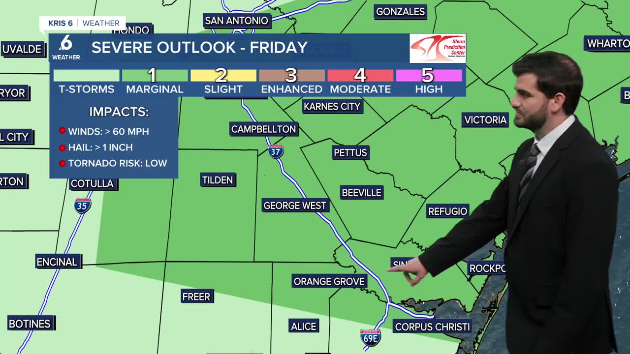
Today the best rain chances are off to the north closer to Beeville and George West and through San Antonio into Central Texas. This is good news for the watershed though which will pick up more rain as a result! Going into tomorrow the cold front drags to the south and puts more of us in the cross hairs for storms and potentially severe weather. Currently we'll be under a level 1/5 risk from Corpus Christi through Orange Grove and to the northeast of that line for hail and high winds as the main modes of weather threats, but an isolated tornado can't be ruled out either. We'll of course keep you updated if anything does get going out there! The showers and storms should come to an end tomorrow night and leave us with cooler weather going into the weekend.
Temperatures
Today and tomorrow both have their fair share of heat and humidity to them. Today we'll be pushing into the mid and upper 80s for most of our daytime highs while tomorrow is pretty similar in the mid 80s. However, tomorrow evening we'll see our next cold front arrive in the region which brings a cool down to the area going into Friday night and the weekend! Saturday my current forecast calls for an afternoon high of 77F and only 80F for Sunday so make sure to enjoy the nicer weather while it's here!

I hope you have a great Thursday Coastal Bend!