
CORPUS CHRISTI, Texas — Happy Thursday!
WHAT YOU NEED TO KNOW
- Temps will slowly decrease
- Scattered showers return Saturday
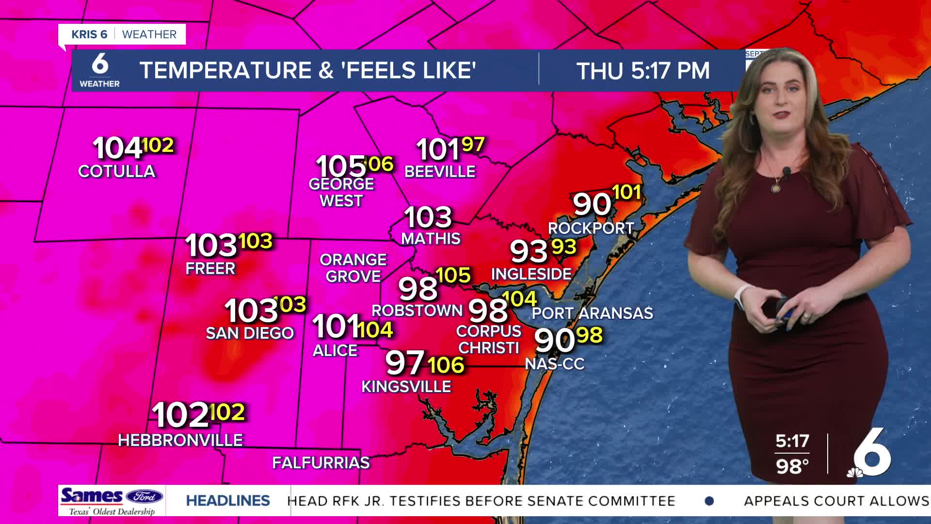
Thursday tied Wednesday for the hottest day of the week— meaning the next few days will be slightly cooler. The weather pattern is changing as high pressure moves away, making room for another cold front to reach the Coastal Bend. Once again, it's still early September, so this will be a weak cold front, but our temps will still be much cooler due to rain. Not only will this cold front be the 'spark' to initiate showers and storms, tropical moisture from the Eastern Pacific is headed our way. This will ensure there is a lot of water in the air above us; any storms that do occur will likely drop heavy rainfall. Rain chances increase late Saturday and remain into the start of next week. It's still early, but the rain outlook is looking good so far.
CORPUS CHRISTI FORECAST
Tonight: Partly cloudy
Temperature: Low 77ºF
Winds: SE 5-15 mph
Fri-YAY: More humid, partly cloudy
Temperature: High 97ºF
Winds: SE 10-20 mph
Fri-YAY night: Warm and humid
Temperature: Low 79ºF
Winds: SE 10-20 mph
Have a terrific evening!