
CORPUS CHRISTI, Tx — Good morning and Happy Monday!
WHAT YOU NEED TO KNOW
- Storms are moving to the east and we're drying up
- Partly cloudy skies and breezy this afternoon in the 80s for highs
- Above average week for temps with the upper 80s daily through the weekend
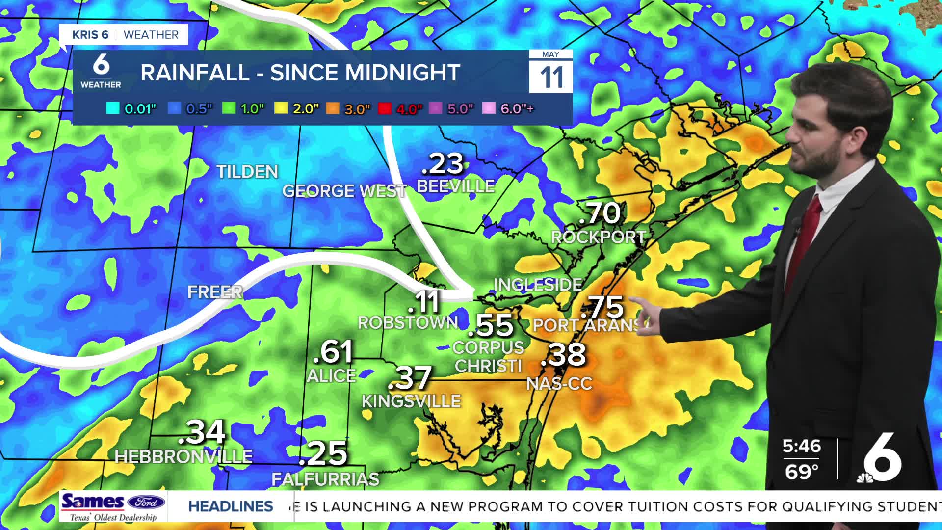
Monday Morning Storms
Early this morning closer to 2am we had storms rolling through Corpus Christi and many areas of the Coastal Bend prior to that as it tracked southeast. It prompted some severe thunderstorm warnings and we had wind gusts upwards of 60-70mph and even one report from NAS-CC coming in around ~84mph! It caused some power outages and damage earlier, but luckily the severe weather is coming to an end and we're drying up after picking up a few tenths of an inch in the rain gauges!
Above Average Temperatures this week
Today we'll be partly cloudy and right back up to the mid 80s for daytime highs that's luckily a little cooler than yesterday thanks to the weak cold front that brought the rain. Winds today will be out of the northeast helping to keep us slightly cooler out there. Going into tomorrow evening we'll see the winds shift back from the southeast bringing in more moisture slowly through the work week ahead. In the mean time we'll be "drier" to start the week with dew points in the mid 60s with daytime highs holding steady in the upper 80s starting tomorrow and pushing through the weekend.

I hope you have a great Monday and start to the week Coastal Bend!