
CORPUS CHRISTI, Tx — Good morning and Happy Monday Coastal Bend!
WHAT YOU NEED TO KNOW
- Numerous Showers and Thunderstorms today and Tuesday
- Flood Watch in effect now through Tuesday night
- Rain chances decrease for the back half of the work week with warmer daytime highs
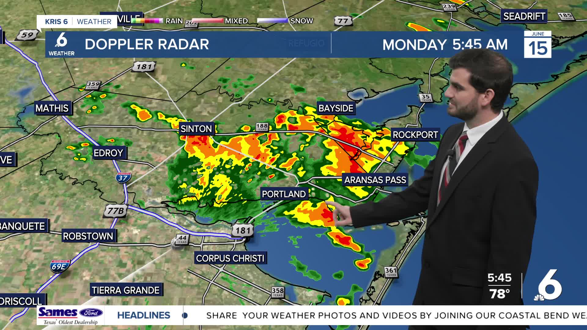
Thunderstorms and Flood Watch
Today we're expecting numerous showers and thunderstorms with heavy downpours at times. This is thanks to a combination of the high humidity in our atmosphere, a tropical low pressure system over northeastern Mexico, and a stalling frontal boundary pushing into the Lone Star state! With multiple means of lift and plentiful moisture we're expecting a decent amount of tropical downpours working their way through the area throughout today and tomorrow. Current rainfall estimates bring in a large area of 3-5" of rain with localized higher totals under the heaviest downpours! Hence the NWS issuing a Flood Watch in effect through Tuesday night. With our already fairly saturated soils it won't take much to see high water over roadways, so make sure to remember turn around don't drown!
Warmer for the back half of the week
By Wednesday night into Thursday the rain chances start to dry up with a ridge of high pressure building back in overhead. With more sunshine heading into the end of the week and the weekend we'll see temperatures back on the rise! After a cool start to the week in the 80s thanks to the rain cooled air, we'll be back to pushing the ~90F mark by Wednesday and Thursday afternoons through the weekend! So after this soggy start get prepared for more of the Summer like heat as we head into Father's Day weekend.
I hope you have a great start to the week and stay dry out there!